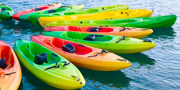
When you’re out kayaking on a large body of water, like a lake or sea, navigation can be tricky. It’s easy to lose sight of landmarks and get turned around.
This is especially true if adverse conditions such as poor light, choppy seas, or fog make you lose sight of the horizon.
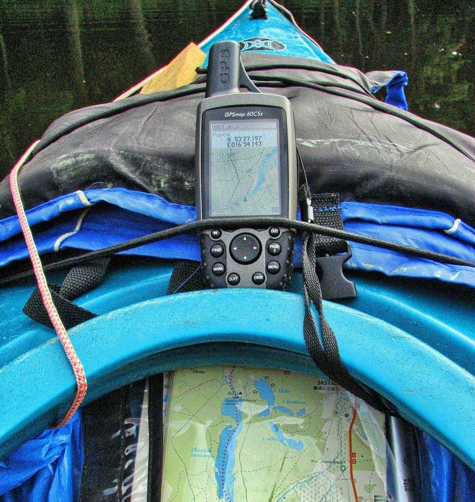
It’s in precisely this situation that a reliable GPS is the most crucial piece of kit. A good GPS system allows you to navigate with confidence and, depending on the model, provide you with weather updates, satellite imagery maps, or even a camera.
The vast majority of GPS products are designed for trekkers, so finding one that is ideal for kayaking takes research. There’s no point in buying an expensive model if it dies the first time it’s splashed with water.
To help you pick the GPS that is right for you, we’ve put together an informative buying guide complete with reviews of the best kayaking-friendly GPS systems on the market.
Best Kayaking GPS
- Garmin Montana 650
- Garmin Foretrex 401
- Bad Elf 2200 GPS Pro
- Garmin GPSMAP 64
- Garmin eTrex 10
- Garmin 72H


Buying Guide – Jargon Buster
Buying Guide – What Features to Consider
Water Resistance and Durability
If you’re taking a GPS out on your kayak, it’s safe to assume that it is going to get wet. It might be a little splash-back from your paddle, or it might be a full-blown capsize.
As most GPS systems aren’t explicitly designed for paddle sports, it’s always best to check to what level your GPS is water resistant. Most GPS manufacturers use the IP code system to signify the water resistance.
It can also get a little rough out on the water, especially in choppy seas or on whitewater rivers. You’ll want your GPS to be able to take a few knocks, even if this is just you accidentally dropping it.
Look for GPS systems that have toughened glass screens, which have been chemically treated to resist damage, and rubberized cases for maximum durability.
Screen Size
Depending on how you choose to carry your GPS, screen size may be a deciding factor. If you are carrying it in a hatch or pocket and plan to hold it as you use it, then having a smaller screen isn’t an issue.
However, many high-end GPS systems come with an option to mount them on the front of your kayak cockpit. If you plan on doing this, then you’ll need to be able to comfortably read the display without changing your paddling position or straining your eyes.
Meaning, you’ll want a larger screen size. Screen size is measured diagonally across the screen face, from corner to corner.
Mapping
Different GPS models come with different maps loaded onto them. Some might only have the country in which you bought it as their default map, but most include a basic world map.
In the vast majority of cases, more detailed maps can be purchased as downloads or on a Micro SD card. On smaller GPS models that only display GPS data, routes and waypoints can be planned out beforehand using compatible computer software, then transferred to the handset using a USB or Bluetooth connection.
Some manufacturers also provide “bluemaps” which contain detailed marine cartography, fishing contours, tidal graphs, current arrows, and even the location of marine services such as the Coastguard. These are even available on some gps watch models too.
Best Kayak GPS Reviews
1. Garmin Foretrex 401

![]()
– Water Resistance: IPX7 (water resistant to a depth of up to 1 meter for 1 hour)
– Basic Mapping Package: Worldwide basemap
The Foretrex 401 is small, lightweight, and designed to be worn on your wrist. While it lacks the detailed visual maps available on larger options, it still contains all the navigational details you’ll need.
The TracBack® feature allows you to retrace the path you’ve already taken, ideal if you paddle into a dead end. The Hotfix-assisted GPS receiver lets you receive signals even when you are under heavy cover.
The Fortrex has enough built-in memory to hold up to 500 waypoints and 20 routes. It can also be wirelessly paired with Garmin heart-rate monitors and cadence sensors for greater utility.
PROS
CONS
Summary: The Foretrex 401 is lightweight, portable, and packs a lot of functions into its small case. The Hotfixing feature also makes it surprisingly accurate, even in heavy cover.
The only downside is that its low internal memory means it can only store a small number of routes.
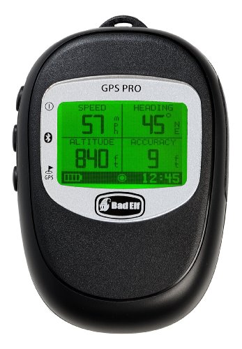
2. Bad Elf 2200 GPS Pro
")
![]()
– Water Resistance: IPX4 (water splashing against the enclosure from any direction will have no harmful effect)
– Basic Mapping Package: Data only
The main selling point of the Bad Elf 2200 Pro is that is can be connected to up to five Bluetooth compatible devices at once. This feature can potentially allow your entire kayaking group to make use of its GPS and data tracking functions.
This does, however, mean your group must be using iPhones, as the connection software requires iOS 8. Other than that, the product only provides basic GPS route tracking and data recording.
The GPS itself is lightweight at just 3.2 oz and fits snugly into the palm of your hand. The IPX4 water resistance makes it essentially splashproof, but it won’t survive being dropped overboard.
PROS
CONS
Summary: The Bad Elf 2200 is ideal for those looking for a GPS that is simple and easy to use. If you want accurate navigation and nothing else, then this might be the GPS for you.
If you want any other functions, you’ll need to look elsewhere.
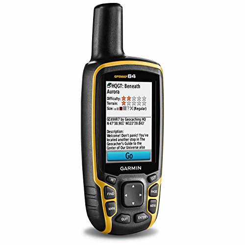
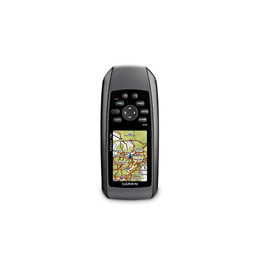
3. Garmin GPSMAP 64

![]()
– Water Resistance: IPX7 (water resistant to a depth of up to 1 meter for 1 hour)
– Basic Mapping Package: Worldwide basemap with shaded relief, preloaded US topographic maps, additional maps available by purchasing a separate microSD card
Compatible with both GLONASS and GPS, the GPSMAP 64 is probably the most accurate of the options on our list. It has a hard-wearing, rubberized case and is IPX7 water resistant, which means it won’t fail the first time it gets splashed or dropped in the boat.
Its transflective, 65-K color, thin-film transistor uses large rubberized buttons, mounted on the sides of the handset, for navigating the menus.
This feature actually makes it more useful for kayakers as you won’t need to remove your gloves to use it. Its internal memory can hold up to 5000 waypoints and 200 routes.
Lastly, it’s geocaching friendly and comes preloaded with 250,000Â geocaching.com caches.
PROS
CONS
Summary: The GPSMAP 64 is a very close second to the Montana 650. With its GPS and GLONASS compatibility, it is exceptionally accurate, even at high latitudes.
The case is highly water resistant and durable. The lack of a touchscreen is less of an issue for kayakers as they will usually be wearing gloves.
4. Garmin eTrex 10

![]()
– Water Resistance: IPX7 (water resistant to a depth of up to 1 meter for 1 hour)
– Basic Mapping Package: Worldwide basemap
The eTrex range of GPS systems is one of Garmin’s most popular ranges. They are inexpensive, durable, simple to use, and accurate. The 2.1″ x 4.0″ x 1.3″ rubberized case is extremely durable and IPX7 water resistant.
The 2.2” transflective, monochrome display is easy to read and backlit for low-light conditions.
The interface is simple and easy to master, although the navigation button may be challenging to use with gloves on. The eTrex is perfect for geocachers as it supports GPX files.
You can download up to 2000 geocaches and details straight to your GPS. At 25 hours of battery life, you won’t have to worry about it cutting out before you get to your cache.
PROS
CONS
Summary: The eTrex range is popular for a reason: They are simple, durable, and they work. If you want to combine kayaking with geocaching and trekking, the eTrex 10 is a fantastic choice.
5. Garmin 72H
-Screen Size: 2.2”
-Water Resistance: IPX7 (water resistant to a depth of up to 1 meter for 1 hour)
-Basic Mapping Package: Worldwide basemap
The Garmin 72H is easily the most basic product on this list. But what it lacks in functions it more than makes up for in durability. It’s IPX7 water resistant and, unlike any of the other GPS options on this list, it actually floats.
Combined with its water resistance, this means you have an hour to fish it back out of the water before you have to worry about damage.
It might be low on functions, but the 72H has a high-sensitivity GPS receiver, which means it can still receive satellite communication even in challenging conditions, such as heavy tree cover or deep canyons.
It also comes with a built-in hunting and fishing calendar and sun and moon information. However, its limited internal memory can only hold 500 waypoints and 50 routes.
PROS
CONS
Summary: The 72H is the ideal GPS for kayakers who want high accuracy but don’t have a use for many additional functions. It’s also perfect for clumsy kayakers as it’s durable, highly water resistant, and it floats.
6. Garmin Montana 650
– Screen size: 4″
– Water Resistance: IPX7 (Water resistant to a depth of up to 1 meter for 1 hour)
– Basic Mapping Package: Worldwide basemap with shaded relief, preloaded US topographic maps, additional maps available via microSD card (not included)
The Montana 650 is the nearest thing you’ll get to GPS system designed purposefully for kayaking. With a rugged, rubberized shell and IPX7 waterproofing, it’s well suited to use on the water.
Its 4-inch color transflective display can be used even when you’ve got your kayaking gloves on. Its 3GB built-in memory will allow you to store 4,000 waypoints and up to 200 routes.
What makes the Montana 650 stand out from other models is the option to add BlueChart® g2 aquatics maps. The Bluechart maps have to be purchased separately, but when combined with Garmin’s Marine Mount, they can give you all the navigation information you need, mounted securely above your spray skirt.
The Montana 650 also comes with a 5 megapixel, sunlight-readable, and autofocus camera. This camera also has a geotagging option so that you can show off your kayaking achievements.
PROS
CONS
Summary: The Montana 650 has all the functions a kayaker could want and, with its higher IP rating, Marine Mount and Bluechart compatibility, it’s about as close as you’ll get to a GPS built specifically for kayakers.
Our Pick: The Garmin Montana 650
All of the GPS products on this list would work in a kayak. They are all resistant to accidental damage and water. Additionally, they are extremely accurate, allowing you to navigate with confidence.
The Montana 650 stands out from the rest because it couples those facets with a broad range of useful features. From a navigation standpoint, it is accurate, Bluechart compatible, and has geotagging and geocaching support.
It comes preloaded with Garmin’s worldwide basemap with US topographic maps. Additional maps, including marine maps, are available via microSD card or digital download.
In addition to this significant level of functionality, it also has a glove-friendly touchscreen and a 5-megapixel camera with automatic geotagging.
Lastly, it can be mounted on your kayak using Garmin’s Marine Mount. The Montana 650 really does have everything a kayaker needs.